Monday, October 5, 2009

California, Here We Came!


Phew! We've been more than a week on the road, and this is the first chance I've been able to use the computer. The first couple of days, going across Nevada, there was no internet service at all. When we finally got to somewhere where we could theoretically get on line, we discovered our aircard had broken (again!) and so we couldn't connect. We are now staying in a very civilized campground with Wi-Fi, so I'm finally able to blog. Maybe. On our Colorado trip in July, I blogged faithfully, but kept getting error messages from blogger.com when I tried to post them, even after we got home. I will try to catch everybody up and keep my fingers crossed that it actually makes it into cyberspace.

The Royal Palms pulled out of the driveway Fridaymorning, September 25th. The excuse for this trip (as if we needed one) was a Skinnie Winnie rally in Laguna Seca, CA, near Monterey. We had attended a rally with this group last summer on the Oregon coast and really enjoyed it, and thought it would be fun to hook up an hang out with our old friends again. While we were at it, we thought we'd stretch it out and poke around central and northern California. I'd always wanted to see Yosemite, wanted to visit my brother in Santa Rosa, and then just wander around for awhile. We'd figured out a tentative route, made some campground reservations, and were ready to go. Then, the week before we were to leave, Steve decided that he really wanted to attend another rally in Farmington, New Mexico, as well. It was happening just a week after the Skinnie Winnies, and he figured we could just make it. No, it doesn't make a lot of sense, but hey, why not!

Yosemite was our first destination, and the usual way to get there from here is I-80, a straight, albeit boring, shot across Nevada. Steve wondered aloud about trying I-6 through Ely and Tonopah, noting that it was shorter and could possibly be more interesting and scenic. Again--why not? Ely was our first stop. I found a great NFS campground up in the mountains south of Ely called Big Springs. The campground had closed for the season (host gone, water turned off), so it was free. Large shady sites and only one other rig in the whole place. It had miles and miles of marked trails for hiking, mountain biking, and cross country skiing, and we spent a couple of hours in the morning before we left exploring on our bikes, the dogs running happily alongside. The photo with the motor home is our campsite. Pretty, huh!

If you've ever driven I-80 across Nevada and thought it was the most barren place on earth, you are wrong. I-6 is, believe it or not, even worse. Once you leave the Ely area, which is quite pretty, things quickly deteriorate. Flat, barren, brown, and dusty. No plants, not even desert plants. A few not especially nice-looking mountain ranges off in the distance. We got across Nevada as quickly as we could and spent the night in a hot, dusty, overpriced campground ($20 no hook ups) near Bishop, CA, because Steve was sick of driving and there weren't any better options.

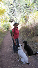
From Bishop, we drove north through a cute town called Lee Vining, and stopped for coffee at a place called Latte-Da. They had yummy homemade pastries as well as drinks, and we each had a slice of chocolate poundcake, chock full of chocolate chips and laced liberally with espresso with our coffees. We stopped at the visitors' center at Mono Lake just outside of town and got camping and hiking recommendations from the ranger for some NFS campgrounds on the way to Yosemite's east entrance over Tioga Pass. Thus it was that we spent my 61st birthday at Saddlebag Lake, elevation 10,087 feet. It's a 20 site campground just above a beautiful blue-green lake ringed by 1200 foot peaks. There's a water taxi that will take you (and your dogs!) across the lake to hike the 5 mile scenic Twenty Lakes Loop, or backpack into the wilderness, but we got there too late to do that, so instead opted for the around-the-lake trail (also 5 miles). It was a flat, easy trail, which was good, because at that altitude, even hiking from the lake up to our campsite got me huffing and puffing. That's Steve and Ellie taking a break, and a view of Saddlebag Lake. I still haven't figured out how to get the pictures where I want them in a post--they mostly end up on top, and out of order. Sigh.

Next day, it was on to Yosemite. I'm going to try and post this now, and finish catching up later. Photos in the next post. Steve is off with the camera somewhere.

Saturday, March 7, 2009

Over and Out

We're home! As usual, I kind of lost interest in blogging towards the end of the trip. Or else got preoccupied with the logistics of it all. We packed up last weekend and left the Ajo area to spend the weekend with our son, Chris, in Tempe. We parked the Palms in his driveway and hung out with him and his new girlfriend, Sharon, all weekend. Low key, but lots of fun. We went to a restaurant called RigaTony's for dinner Friday night; it was wonderful--a small, local chain similar to Olive Garden, but even better. Saturday night, Chris hosted a barbeque for friends, and we spent the afternoon shopping for ingredients for the skewered chicken tenders Sharon was going to make. Some of them were fairly exotic (have you heard of galangal--I hadn't!), so Chris took us to LeeLee's. It's an Asian/international market in Chandler, and if they don't have it, you don't need it, and it probably doesn't exist anyway. Sharon was moved almost to tears when she found the specific brand of lime pickle that she loves and hasn't seen since she moved from New York to Tucson several years ago. The produce section had every imaginable and unpronounceable vegetable, fruit, and melon known to man; the meat department, along with familiar and unfamiliar cuts of meat and whole frozen fish, featured a wall of fish tanks holding sea bass, tilapia, and catfish. Theoretically, you could pick out the exact fish you wanted, and they'd net it, kill, it, and clean it for you before you left the store.

After Chris's, we drove to Sun City West and stayed with my parents. We had made an appointment at Al's RV Service in Glendale, about 12 miles away, to get the levelers fixed. Al's is one of the two places in Arizona that has a certified HWH master mechanic (Utah has none!). They quickly determined that the levelers failed for one of two reasons--a bad computer chip in the control panel or one in the motherboard, both quick fixes once you had the very expensive part. They called HWH in Iowa, who, amazingly, said they would cover it, even though it was out of warranty. The only thing we had to pay was $45 to have the parts overnighted from Iowa to Al's. Once the parts arrived, it took Al five minutes to determine which chip was bad and another fifteen to unscrew the control panel and pop in the new chip.

We took two days to drive home, staying at our favorite Cedar Pockets Campground in the Virgin River Gorge, about halfway. Because we were coming back to winter, Steve wanted to avoid as many mountains as possible, so we went home the Las Vegas way rather than the Flagstaff way we came down in January. The only bad thing about this route is having to drive the freeway through Las Vegas, always nerve-wracking and jammed with fast-moving traffic. Steve consulted some maps, and found a road that wound around the west side of Lake Mead and dumped us out on the north side of Vegas near I-15, but avoiding the downtown Vegas freeways. The "short-cut" was a very scenic, quiet, good two-lane highway. We will definitely use this route again.

We came home to snow flurries, with a fair amount of the white stuff on the ground. We've started the tedious business of unpacking. Not sure where or when our next trip will be. We're expecting our second grandchild in mid-July, so any summer trip would have to be after that. We'll keep in touch.

Wednesday, February 25, 2009

Cabeza Prieta National Wildlife Refuge


Cabeza Prieta means "Dark Head" in Spanish, and refers to a peak in one of the mountain ranges around here. Our campsite is actually within the refuge, which is the 3rd largest in the lower 48 states. It encompasses over 800,000 acres, seven mountain ranges, and a variety of habitat for many species of plants and animals, including 6 kinds of rattlesnakes and 212 different kinds of birds. Earlier this week, we paid a visit to the visitor center in town, and left with the necessary maps and permits to go exploring. It's all very wild and rugged country, with absolutely no amenities--like water or road signs.The permit is good for 90 days, but you have to call in each time you use it so they can keep track of visitors. You call in and leave a message, stating your permit number, how many vehicles, and what your destination is. The recording states firmly that you are on your own--they don't want your name, license plate number, or when you plan to return because they aren't going to send someone out looking for you if you don't come back when you said you would. So there!

Tuesday, we set out for El Camino del Diablo (the Devil's Highway). The route was pioneered by a conquistador named Juan Bautista de Anza in 1774, and got its name after hundreds died on the route on the way to the California gold fields in 1848. From where we are, the route goes south into Mexico or north to Yuma, maybe farther. It bumps and grinds along the Mexican border, so we saw a lot of Border Patrol guys. Part of the road is very sandy, and they drag tires behind their trucks every day to smooth out the sand so they can see and track footprints. The "highway" crosses into Organ Pipe Natonal Monument, and at first it was very scenic. Lots of saguaro cacti, with "arms" going in all different directions. Once we left the monument, however, the road lost its charm. The bumps got bigger, most of the plants disappeared, and there was nothing but barren desert. This is apparently one of the areas where good Samaritan groups leave water jugs out for illegals crossing the desert because so many people die making the attempt. We turned around after about 20 miles hot and tired and dusty despite being in a car, with water, Diet Pepsi, and peanut butter and jelly sandwiches. I can't imagine trying to do it on foot.

Yesterday, we took off in a different direction, in search of the petroglyphs at Charlie Bell Pass. It was a 17 mile ride, with good dirt road for more than half of it, and crummy for the rest. We dubbed one part Boulder Highway because, for about a mile, it was nothing but rocks. When we got to the end of the road, we parked the car and started hiking down into the valley on an old jeep road. We saw a snake about 2 feet long, not a rattler, sunning himself on the trail.The volunteer at the visitor center had said it was about a half mile to the windmill and petroglyphs, but it was probably twice that. The windmill was active, pumping water from a well into a big enclosed tank. There was an open, overflow tank that Ellie jumped into to cool off, and a spigot where we could fill up our water bottles. It was a hot day, and Steve and I both took off our T-shirts and got them sopping wet for the hike back up the hill. They were dry before we reached the top. The petroglyphs were inscribed on individual volcanic rocks scattered all over the hillside near the windmill and well. There must have been hundreds. Our guess is that there must have been a spring where the well is now, and the early peoples either came here to get water or settled here because of it.

Although we had brought drinks, we hadn't anticipated being gone so long, and didn't bring snacks. By the time we got back to Ajo, it was 3 p.m. and we hadn't eaten since breakfast. We pulled into the Dairy Queen andf chowed down on burgers, fries, and Oreo Blizzards. I'm usually not a big Dairy Queen fan, but either this was a really good one or we were too hungry to be picky--everything tasted great!

Today so far, we're just hanging out. Steve plans to get under the Samurai and secure some tin plate near the muffler that the the roads here have rattled loose. We may do a little excursion this afternoon to some old (not ancient) Indian settlement nearby. Tomorrow, we want to go to the Barry Goldwater Testing Grounds, which are (weirdly) also in the wildlife refuge. First we have to go the visitors center and watch a 25 minute orientation video ("when you see a plane, duck?") and get the password of the day to unlock the gate.

Tuesday, February 24, 2009

Local Color


Here are some pictures. Tex and John's Hey are best friends. When they aren't biting each others' necks, they are sharing sticks, sleeping next to each others, or chasing each other around. John found Hey in a Wal Mart parking lot, skin and bones, begging food. She was about 8 months old and had already had a litter of puppies before she was dumped. The big dog in the picture of me is Chris's Ollie. He's a Labrador/Catahoula mix. I'm not sure if that makes him a Labrahoula or a Catahoulador, but either weay, he's a big, sweet, goofy guy. That's our Gila woodpecker. He likes the oragnes, but not the lemons.

Pictures


These are the ones Chris took with his new camera. Three finger rock is right behind our campsite--a five minute walk. "Trailer Trash" is self explanatory.

Monday, February 23, 2009

Life in Ajo

The weather has finally turned consistently warm. Low to mid 80's during the day and low 60's at night. Steve actually had to turn the Royal Palms around so our "patio" was on the shady side. It was way too hot sitting outside in the sun. (I know that all you Salt Lake folks are feeling sorry for us). Chris was here for the weekend with his big dog, Ollie, and his new camera. He took the pictures for this post. If they had captions, they would be "Red Tailed Hawk," "Three Finger Rock," and "Trailer Trash." The "trash" (except Big John) are all zonked out from a mountain bike ride earlier in the day. Dogs too.

This morning we were awakened by a Gila woodpecker. He was scolding us from the palo verde tree where his breakfast ought to be, reminding us that the oranges sections wee had placed there were all dried up and he wanted some fresh juicy ones.. Last year, we had three or four of the little guys fighting for the goodies we hung in the tree outside our window. This year, only one so far. He lives in a giant saguaro nearby; you can see the little round hole he's bored out, and he perches on top, proclaiming that this is his territory, or maybe trying to attract a girlfriend.

Oops! The picture files are HUGE and blogger doesn't want to take them. I tried to get them resized, but the website I use for that doesn't seem to be working this morning. I'll try again later.

Friday, February 20, 2009

Ajo!

Ajo is about 160 miles from Yuma, an easy drive, and most of it quite scenic. Steve drove us right to our camping spot from last year, and we settled in. We drove around a little and found John and Hey, camped along a bigger road. He has to go into town for water today, and then will move over here in a spot next to us. Chris will be coming down from Tempe tomorrow to spend the weekend. Thanks to Steve installing an aerial on top of the Royal Palms before we left home, we can now get an internet connection right from our campsite. Last summer we had to go into Ajo and use the library computers. When we got here yesterday afternoon, the temperature was 78 degrees. I put on my shorts! It's still a bit crispy at night, but we're not complaining. And oh, the stars at night!

I need to run into town this morning and pick up some maps at the wildlife refuge office, and then we plan to go exploring this afternoon in the Samurai. I'll take some pics of our campsite and the area and add then to the next post.